2001
Specimen academicum inaugurale de geologia patriae
Publication
Publication
Staringia , Volume 10 - Issue 1 p. 1- 174
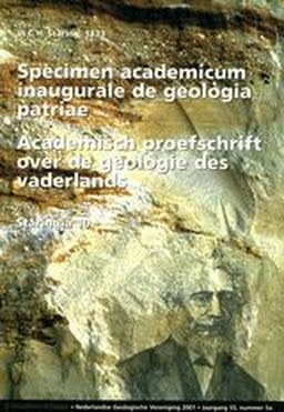
The thesis which earned Staring a doctor's degree at the University of Leiden in 1833 is here presented in a Dutch translation. It was originally published in Latin, as was customary in those days and consequently hardly accessible to the present-day reader. However, it is still an interesting document from a historical point of view for several reasons. Firstly it is the first work summarising the geology of the Netherlands, secondly because of its early date of publication – it appeared only a few months after the third volume of Lyell's Principles of Geology – , and thirdly because of the person of the author: Staring is quite rightly considered the father of Dutch geology. Moreover a few details are given of Staring's life and work partly borrowed from Huberts's (1877) and Veldink's (1970) biographies. Winand Carel Hugo Staring was born in 1808 at his father's estate 'De Wildenborch' near Vorden in the eastern part of the country. He registered as a student in the Faculty of Law at Leiden in 1827, but he soon switched to the Faculty of Natural Sciences with special emphasis on biology. Having grown up in the country he was evidently more inclined to read natural science than law. He was moreover particularly influenced by the lectures of professor C.G.C. Reinwardt. In 1831 J.G.S. Van Breda entered the Faculty as a professor of geology. He had fled from Gent after Belgium became independent. After the publication of the thesis Staring hoped to devote his time and energy to further the geological knowledge of the country. However, paid functions were not available and Staring acted as a steward on his father's estate. Here he divided his time between geological studies in the area and agricultural problems. The year 1852 was a milestone in Staring's life. On the initiative of agricultural societies the liberal prime minister J.R. Thorbecke appointed a government commission charged with a geological survey of the country. Van Breda acted as a chairman, the botanist F.A.W. Miguel as a member and Staring as a secretary. From the onset it was clear that the work proper should be done by Staring. Thorbecke put a beautiful country house the 'Paviljoen Welgelegen' near Haarlem, at the disposal of the Commission as its headquarters. There living quarters for the Staring family were also available. Here originates the connection between the geological survey and Haarlem (which ended in 1999). Internal problems in the commission, probably mostly between Van Breda and Staring, led to the dissolution of the commission, after which Staring was the only one charged with the completion of the map in 1857. He managed to complete the survey in 1860 in twenty sheets on the scale 1 : 200.000 by himself. The printing by the Topographical Survey of the War Ministry was not completed until 1867. The map was awarded a special prize at the World Fair in London in 1862, because of its very detailed legend of Quaternary deposits. While surveying the country Staring also wrote a two-volume geological work De bodem van Nederland (1856 and 1860). In the same year 1860 Staring also published a schoolmap of the Netherlands on the same scale as the official geological map. This schoolmap is a most remarkable publication. It appeared as a physical and economical map meant for use in schools. The physical features largely represent the results of Staring's geological survey. In view of his official government commission he wanted to avoid the term geology in the title of the map. The economical features show the land usage in black symbols printed across the geological colours. The official geological map was reprinted only once, whereas the schoolmap saw many reprints, the last of which appeared as late as 1973. The survey completed, Thorbecke dismissed Staring as a paid geologist in 1863, much to Staring's regret as he had hoped to continue his geological investigations in order to review the map. He was appointed an inspector of secondary and agricultural education in the northern provinces. However, he remained active in the fields of agriculture and geology as is clearly shown by his many publications. Staring died in 1877, the same year when chairs in geology were established at the three state universities in the Netherlands (Leiden, Utrecht and Groningen) following the introduction of the Higher Education Act of 1876. In his introduction Staring refers to the works of a number of earlier investigators, particularly J.A. de Luc, J.FL. Hausmann and J.B.J. d' Omalius d'Halloy. Part I The boundary of the area described in Staring's dissertation follows the northern limit of the belt of Cretaceous rocks that runs from the French Channel coast eastward through Belgium and the southernmost area of the Netherlands near Maastricht bending northward into Germany. Consequently the Upper Cretaceous deposits of southern Limburg with the type area of the Maastrichtian Stage are not discussed here. On the other hand nearly all of the Tertiary dealt with by Staring belongs to the Belgian area. Very few outcrops of Tertiary deposits in the Netherlands were known. Staring follows the subdivision of Tertiary deposits introduced by Van Breda when still a professor in the University of Gent. In a general way the succession described by Staring is from bottom to top: Argile plastique, Calcaire grossier, London Clay, Bagshot Sands and Crag sands. It is observed that many alternations occurring in the Paris basin are much less distinct in Belgium. The Crag deposits are considered to be a part of the Diluvium because its fossil content resembles other Diluvial deposits. Staring gives much attention to the clay deposits discovered during the construction of the Antwerp docks. They were particularly rich in Cetacean remains. A similar feature was noted in a claypit in the eastern part of the province of Gelderland. Staring doubts the conclusion reached by De la Jonkaire that these deposits belong to the London Clay [they are now considered to be Miocene.] . A list of fossils is printed on pages 13 -18. Part II Staring considers the Diluvial deposits in the Netherlands as part of a much larger area that reaches from Poland in the east to East Anglia in the west. The Diluvial formation is clearly distinguished from older formations by its less coherent constitutions and from the younger Alluvial deposits in a broad zone along the North Sea by its dominant sandy character with abundant pebbles and larger rock fragments. In contrast to the Diluvial area the Alluvial area is dominated by clay deposits and by its flat topography. Evidently the Diluvial deposits continue below the Alluvium, as is witnessed by isolated hills of the Diluvium, e.g. the higher part of the island of Texel. Staring is clearly aware that the blocks in the Diluvium are partly of northern and partly of southern origin. In the northern Diluvium igneous and metamorphic rocks predominate. In general they seem to be of 'Primitive' [Archaean and Proterozoic] age. In the northern part of the country blocks of sedimentary rocks occur locally. They should be considered as originating from the Transitional Group [Werner's 'Uebergangsformation', essentially Lower Palaeozoic]. In the southern Diluvium pebbles from the Transitional Group outcropping in the Ardennes mountains and Rhenish Schieffergebirge prevail, igneous rocks (porphyr and basalt), occur more rarely. Rock fragments of Mesozoic age identified by their fossils occur only rarely among Diluvial pebbles. Little attention is paid to the relief of the Diluvial area. Staring clearly distinguishes between the larger higher area of the Veluwe and the Utrecht hilly ridge, and the smaller more isolated ridges further to the east in the provinces of Overijssel and Gelderland. Usually they show a more or less northsouth orientation. Particularly in the Veluwe area inland dunes are widespread. In the lower parts of the Diluvial regions Alluvial deposits by rivers and brooks occur. Apart from pebbles and larger stones the Diluvial sands contain many mammalian bones. A list of fossils is printed on pages 25 – 29. According to Staring the fossils clearly distinguish the Diluvium as a separate formation. The mode of origin of the Diluvium is discussed from three different points of view: (1) the origin proper of the material, (2) the mode of transport of the material and (3) causes responsible for the special conditions prevailing during the Diluvium. A local origin of the Diluvial material is excluded because no traces of such rocks in the subsurface are known and the rocks are of a mixed character. It is pointed out that most of the igneous and metamorphic rocks resemble the solid geology of Scandinavian countries. Fossiliferous sedimentary rocks, particularly limestones, could have originated from Scandinavian countries as well as from the Ardennes mountains and the Rhenish Schieffergebirge. It is concluded that the Diluvium in this country is formed by two different parts: Northern Diluvium and Southern Diluvium. As to the mode of transport a number of possibilities mentioned by previous authors are discussed. Large fluids are most likely responsible for the transport. The collapse of natural dams in Scandinavia seems a possible explanation for such enormous floods. Changes in sea level, however, are not excluded. Transport by marine currents remains a possibility, and even icebergs may have played a part. Changed conditions during the deposition of the Diluvial formation may have been caused by heavy rainfall, by changes in the position of the earth axis, or other astronomical events. Part III The third part is devoted to the Alluvium. Staring starts by referring to Lyell's uniformitarianism, and stresses the importance of a careful study of Alluvial deposits for the explanation of earlier formations. There is a clear distinction between Alluvium and Diluvium, although the boundary between the two is not always clearly defined. The flat topography of the Alluvium and the much smaller size of pebbles, if present at all, strongly suggest that the forces operating during the Alluvium were much weaker as compared with the Diluvium. The chapters I and II deal with the peat deposits forming an essential part of the Alluvial formation. A distinction is made between lower peat deposits, the base of which is usually below the water table or even below sea level, and the higher peat deposits resting on sandy Diluvium. It is widely accepted that plant material is the origin of all peat deposits. Whether such deposits originated in situ or whether they were moved from higher ground as suggested by J.A. de Luc is open to discussion. However, Staring seems to have a preference for an origin in situ. The chemical processes involved in peat formation were not well understood in Staring's time. Consequently several pages are devoted to this topic. Staring is well aware of the importance of the ground water table in relation to peat formation. In many of the peat bogs in the lower part of the country the base of the peat is below the ground water table. Whether the present situation is due to sea level movements or to subsidence remains unclear. Fluvial Alluvial deposits (chapter III) mainly consist of clay. They are difficult to distinguish from marine Alluvial deposits in which they gradually pass in seaward direction. An arbitrary boundary is accepted at the level of high tide, although under exceptional conditions differences may occur. Moreover it should be taken into account that the tidal level may have been different in the past. The material deposited by fluvial activity is dependent on current velocity; a number of data on current velocity in present-day rivers are presented. Sandy deposits are usually confined to the upstream parts of the larger rivers and to the border areas of smaller rivers and brooks on the sandy Diluvial part of the country. Locally sandy deposits may occur within the clay deposits as a result of upwelling from deeper levels during flooding or dam burst. Ferruginous concretions or layers of limited extent occur locally in Alluvial formations, or are associated with depressions in clay beds. The origin of the iron may be found in vegetational matter or it may have been transported from elsewhere. Fossils in Alluvial formations all belong to recent species and are sometimes associated with human artefacts. Marine Alluvium (in chapter IV) is characterized by a flat surface, although locally artificial hills ('terpen, wierden, vliebergen') occur. Its highest limit coincides with the hightide level or spring-tide level. Clay and sand, containing recent species of molluscs, are the most common sediments. Usually the main clay is on top of the sand. In the northern provinces (Groningen, Friesland) a zone of peat bogs separates the marine Alluvium from the Diluvial formations. In Holland on the other hand the peat bogs are situated on top of the clay. In former centuries the peat was removed to serve as fuel. Many lakes originated in this way and many of them have been reclaimed ('droogmakerijen'). The clay bottom yields fertile agricultural soil. Apart from several wells hardly anything is known about the thickness of the marine Alluvium or about the nature of the underlying formations. Chapter V on aeolian Alluvium deals with the dunes, distinguished in coastal dunes and inland dunes. The coastal dunes of the country are part of a much larger coastal dune chain along the North Sea, from the French Channel coast near Calais until Denmark. Interruptions occur in the inlets between the Frisian islands in the north and the islands of Holland and Zeeland in the southwest. Between Haarlem and the Hague the inland part of the coastal dunes show long ridges separated by plains up to one kilometer wide. Usually the plains have a thin layer of peat. Most of these interior dunes as well as the plains are used for agricultural purposes. The coastal dunes proper show lower parts blown out in the direction of the prevailing wind. For the rest they form one uniform entity of varying width. The origin of the sand must be found in the shallow bottom of the sea. It is carried to the shore by tidal currents before being further transported by wind. The origin of the sand is not yet clear. De Luc considers the sand as deriving from Diluvial deposits in the bottom of the North Sea. It should however be borne in mind that the present coastal dunes are not immediately resting on Diluvial deposits. The inland dunes are situated in the part of the country where Diluvial deposits form the surface. They are particularly widespread in the Veluwe. Apart from not being affected by marine conditions they do not differ fundamentally from coastal dunes. In large parts of the inland dunes the sand is fixed by pine wood in order to save agricultural grounds from being blown over. Staring ends his thesis by summing up in 12 points a program for further research, a good deal of which he accomplished in later life himself.
| Additional Metadata | |
|---|---|
| Staringia | |
| CC BY 3.0 NL ("Naamsvermelding") | |
| Organisation | Nederlandse Geologische Vereniging |
|
Winand Carel Hugo Staring. (2001). Specimen academicum inaugurale de geologia patriae. Staringia, 10(1), 1–174. |
|